
Accurate determination of property lines and corners for legal documentation and dispute resolution.
Detailed mapping of natural and man-made features including elevation contours for design and planning.
Precise marking of proposed structures, roads, and utilities according to approved plans.
Mapping of underwater features for coastal development, dredging, and marine construction.
Division of larger parcels into smaller lots in compliance with local regulations.
Comprehensive surveys meeting national standards for commercial real estate transactions.
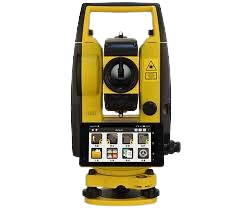
High-precision electronic theodolites with distance measurement for accurate angle and distance readings.
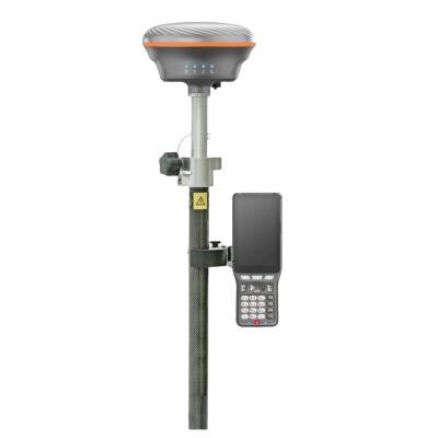
Real-time kinematic GPS for centimeter-level accuracy without traditional survey markers.
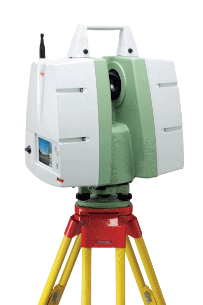
High-definition surveying that captures millions of data points for comprehensive as-built documentation.

Photogrammetry and LiDAR from UAVs for large-area topographic mapping with reduced field time.
We analyze your requirements, property size, and terrain to determine the appropriate survey methods.
Our licensed surveyors conduct on-site measurements using advanced equipment to collect precise data.
Field data is processed using specialized software to create accurate maps and legal descriptions.
Multiple verification steps ensure the accuracy and reliability of all survey deliverables.
You receive certified survey drawings, digital files, and any required legal documentation.
A professional land survey establishes your property boundaries, identifies easements or encroachments, and provides the legal foundation for construction or property transactions.
The duration depends on property size and complexity, but most residential surveys are completed within 3-5 business days after site visit.
We use robotic total stations, RTK GPS systems, 3D laser scanners, and drone technology for the most accurate results.
Yes, all our surveys are conducted by licensed surveyors and can be used for legal purposes including property disputes and construction permits.
Contact us today to discuss your project requirements and receive a free quote from our licensed surveyors.